PAGASA Track as of 8 p.m., 04 April 2015 Satellite Image
chedeng 15040412
chedengsat 15040415
SEVERE WEATHER BULLETIN NUMBER TEN
TROPICAL CYCLONE WARNING: TROPICAL STORM “CHEDENG”
Issued at 11:00 p.m., Saturday, 04 April 2015
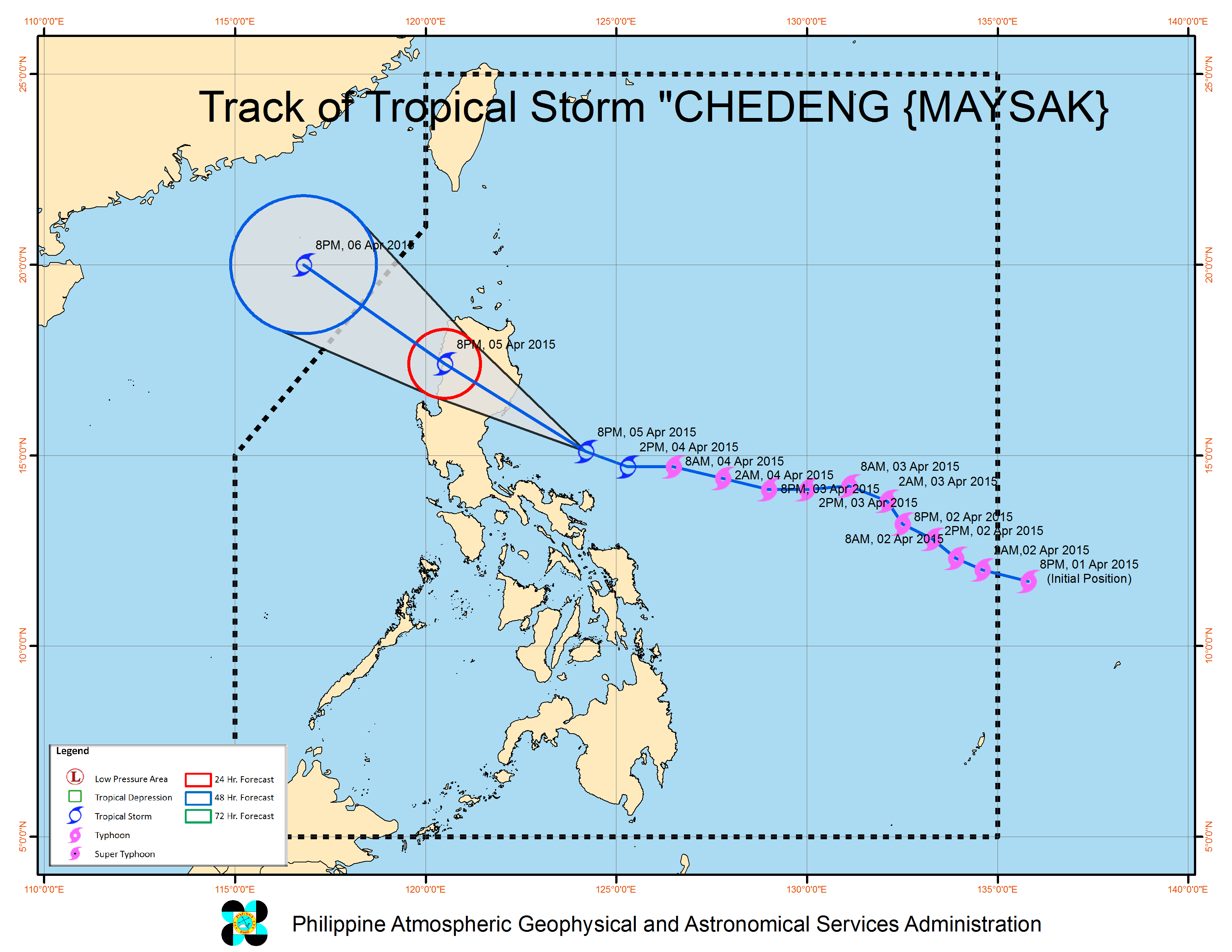
Tropical Storm “CHEDENG” is now moving closer to eastern coast of Isabela-Aurora area.
Location of Center:
(as of 10:00 p.m.)
220 km Southeast of Casiguran, Aurora
Coordinates: 15.3°N, 123.9°E
Strength: Maximum sustained winds of 95 kph near the center and gustiness of up to 120 kph
Movement: Forecast to move West Northwest at 20 kph.
Forecast Positions/Outlook:
24 hour (Tomorrow evening):
in the vicinity of Santa Maria, Ilocos Sur
48 hour (Monday evening):
445 km Northwest of Laoag City or outside the Philippine Area of Responsibility (PAR)
Public Storm Warning Signal
PSWS Luzon Visayas Mindanao
#2
(winds of 61 – 100 kph
is expected in atleast
24 hours)
Isabela, Aurora, Quirino, Nueva Viscaya, Benguet, La Union, Mountain Province, Ilocos Sur, Abra, Kalinga, Ilocos Norte and Ifugao
None
None
These areas will have stormy weather with heavy rains.
#1
(winds of 30 – 60 kph
is expected in atleast
36 hours)
Catanduanes, Camarines Norte, Polillo Island, Nueva Ecija, Pangasinan, Cagayan and Apayao
None None
These areas will have occasional rains with occasional gusty winds.
Estimated rainfall amount is from moderate to heavy within the 150 km radius of the tropical storm.
It is expected to make landfall over the coast of Isabela-Aurora Area by Sunday morning (April 5), will exit the landmass via Ilocos Sur by Sunday afternoon (April 5) and will exit PAR by Monday morning (April 6).
Residents in low lying and mountainous areas of the provinces with PSWS#2 and PSWS#1 are alerted against possible flashfloods and landslides.
Sea surface waves of up to 3-4 meters near the center of the Storm.
Fisherfolks are advised not to venture out over the northern seaboard of Luzon and eastern seaboard of Bicol Region.
The public and the disaster risk reduction and management council concerned are advised to take appropriate actions and watch for the next bulletin to be issued at 5 AM tomorrow.
